EMMA Pro – Environmental Monitoring Management Application
The Environmental Monitoring Management Application stores environmental data in a database which allows access of the data through a geographic interface. The data stored within the database can be queried, exported, processed and re-mapped through the geographic image or map.
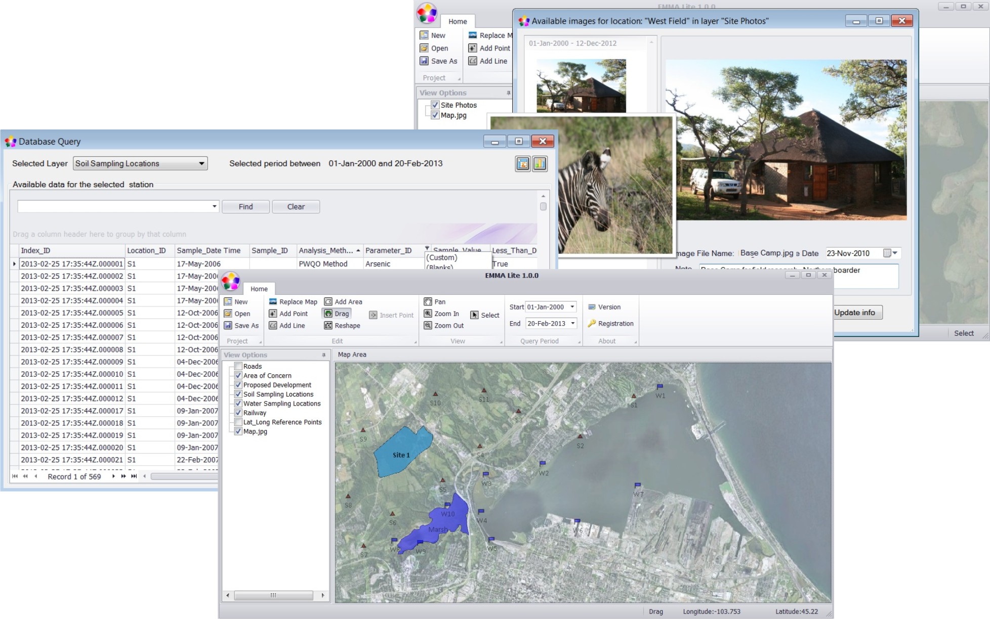
EMMA Pro is designed to manage field measurements and images in an organized manner, allowing for easy access to site specific data.
Applications of EMMA Pro Include:
-
Access Data through Points on a Map
EMMA Pro provides unique mechanisms of accessing data directly through the image or map. In just a few clicks, users are able to import data through the geographical interface.
-
Develop Visual Appealing Projects
EMMA Pro allows users to add and remove layers for each project. A reference layer is only one set of a layer which can be added to any site or project that requires a visualization of roads, rivers, lakes, towns, rail etc.

-
Import Query and Report Real-time Data
Accessing and querying data is important, though accessing and querying data based on dates and time is just as important. EMMA Pro allows users to customize reports based on specific time lines.
-
Manage Site Photos
Allowing for visual aids, helps users understand the impact of the site or area in question. EMMA Pro allows users to manage site photos, embedded comments as well as associate time and dates for the image.
-
Latitude and Longitude
Reference points in EMMA Pro is very easy and straight forward. EMMA Pro is designed to allow users to input latitude and longitude into the EMMA Pro interface through its own layer. By incorporating latitude and longitude into the software, EMMA Pro allows users to add data points with accurate locations.